An aerial survey of the south west, taking place over the next few months, could help predict future flooding and landslides.
Planes will be flying as low as 80 metres over open countryside, and higher over built-up areas.
The project has begun at the western tip of Cornwall and will reach Exeter some time next month.
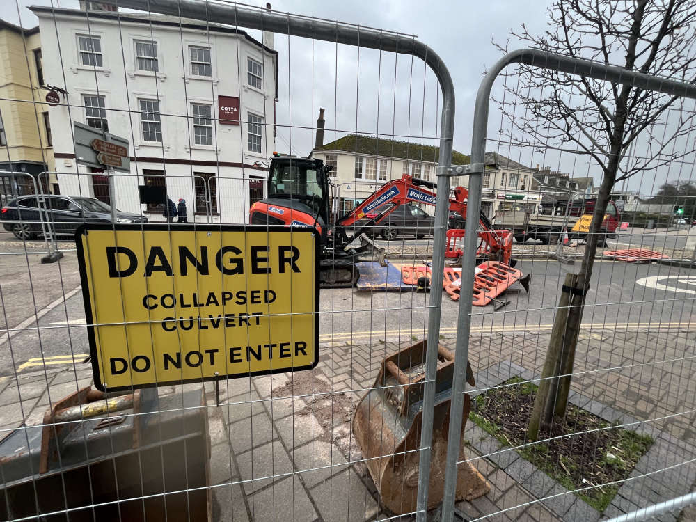 Roadworks frustrating Kingsbridge locals
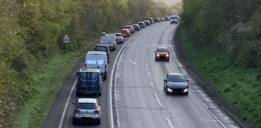 Fears homes will create more gridlock on “car park” roads
 Kart track wants to host large event
 Devon rapist jailed for 26 years
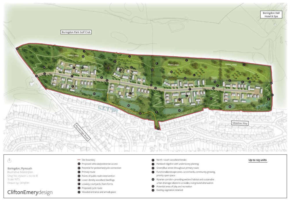 125 homes proposed for Plympton
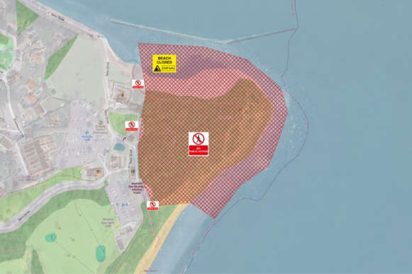 ‘Stay clear’ warning after Shaldon cliff fall